Tuesday, May 31, 2011

Day 16: Weekdays in Western Illinois

Nauvoo, IL to Burlington, IA

Stats!
Miles biked today: 44.6
Total miles biked: 552.6
Max speed: 26
# of dollars spent at bike shop: hundreds
# of yawns on the road: 22

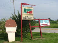
Today was kind of a slow day. Dean and I woke up to rain in our tent at the Nauvoo Dairy Sweet. The weather predicted scattered thunderstorms all day. We tried to wait it out a bit in the morning, but it never really stopped. So we packed up our wet tent in the rain. Yuk!

Right as we were ready to set off, we heard terrible thunder, so we decided to bike into Nauvoo "downtown" to go to a used bookstore. It turned out to be all Mormon books (Nauvoo has a large Mormon community), so we didn't stay long. We figured we'd have to get on the road at some point, so we just got going.

Every day on the road, the first 10 minutes are the hardest (all things being equal). Your butt is really sore, and your quads are exhausted, and everything in your body is just begging you not to do this to it again. The first 10 minutes today, we had all that, plus rain.

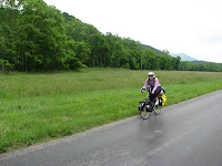
But after those first few miles, you feel much better, and once we got going a bit, it was cloudy but mostly dry. We saw some AMAZING lightning bolts way off in the distance. When it's flat, you can see just about forever. It wasn't even raining where we were, but those lightning bolts were pretty impressive.

Much of what we saw today looked like just what I imagined the midwest looked like. Flat and farms forever. We were biking on a huge grid most of the day, just like a city would have, except there was only a road every mile. Farmland in each block. It was pretty, though, and the changing color sky and clouds accented it.

We stopped for lunch in Lomax, IL, in a place called "The Pink." This was the first ever place we felt unwelcome on the trip so far. Mostly everyone has been very interested in our trip, and very friendly. On the way out I spotted an unusual license plate. If you got a vanity plate, what would yours say? ;)


We knew we wanted to stop in Burlington, Iowa today because they have a bike shop, and we were in dire need of all kinds of supplies. But we had started out so late because of the rain, and we were both pretty tired (from sleeping in the tent, maybe?), so we decided to just stay in Burlington tonight.

The bike shop trip was a major success, and we also went to Target and got some books for Dean. He finished his book a few nights ago, and has been hurting for one ever since.

Tonight we are staying at the Motel Lincolnville, or as it's known in lights, the El 'Nville. It's one of Burlington's least fine establishments, but right in our price range!

Tomorrow we hope to make it to Muscatine, IA. I hope you're all still enjoying the blog!

Monday, May 30, 2011

Day 15: Into the Great Wide Open

Hannibal, MO to Nauvoo, IL

Stats!
Miles biked today: 73.1 (a new record!)
Total miles biked on trip: 508.0 (a new century!)
Max speed: 31.0 mph
# of motorcycles that passed us (going both directions): 117
# of degrees Fahrenheit: 93
# of closed bike shops: 2
# of state lines crossed: 1

All last night I dreamed about biking. Our rest day in Hannibal, while sorely needed, was pretty darn boring, and I was ready to get back on the road. We even only ate 3 meals on our rest day, and I think we could have been okay with 2. But since we ended up biking so much today, I'm glad we had the third.

We set out this morning pretty early, and started the day with a quick jaunt on the interstate -- I-72. It allows bikes across the bridge over the Mississippi only, and there's a HUGE shoulder, so it wasn't very scary. Still, I was glad to get off the interstate, and be welcomed in Illinois, the land that loves Lincoln (as Dean pointed out, we love Lincoln, too, but Illinois is almost as proud of Lincoln as Missouri is of Twain. I'm not sure if Illinois should be more proud or Missouri less... ?).

The great majority of our first 55 miles today were F L A T. It was glorious! You could see for miles and miles. In fact, I had the song that goes, "I can see for miles and miles and miles and miles," in my head, along with the Peter Pan tune, "You can fly, you can fly, you can fly!" We were going about 20 mph for much of the way, due to the extreme flatness and a rare tailwind.

We were excited to stop in Quincy, IL because there was a bike shop there, and we need various items that you can pretty much only find at bike shops. It was closed for the holiday, as was the one in Hannibal. No luck at all for us on that front.

Quincy was also our last chance to feed and water ourselves for another 35 miles, so we hit the local Irish pub (most everything else was closed for the holiday) and had a fine meal before hitting the flatlands again.

The wide open spaces are pretty, but it does get a bit monotonous. I'm not complaining, though! I'll take 70 miles of flat over 15 miles of mountains any day of the week and twice on Sundays (and national holidays).

We also stopped in Warsaw, IL. That town had been our original goal destination, but since we got there at 1 p.m. and Nauvoo was only another 20 miles down the road, we decided to press on. We had a WONDERFUL second lunch there. It was hot, hot, hot and without much shade on our route. After 35 miles of that, we were ready to cool off and refill our water bottles ASAP. The cafe where we stopped had the most delicious lemonade I've ever had. We left feeling very refreshed.

That was good, since the last 20 miles were hilly. It wasn't bad at all -- they were all achievable -- but when you've already biked 55 miles, 20 miles of hills seems a bit harder. Dean and I now have two categories of hills -- achievable and "walkers." We hit two walkers today only, both going into towns from the flat riverside.

Speaking of which, the river is still a bit flooded, and we saw lots of underwater picnic tables and such.

Tomorrow I am hoping for another super flat day. Even if it's a little bit hilly, we should make it to Iowa. Exciting!!

I feel really good about how far we biked today. It really shows how far we've come from day one. 63 miles that day was killer, and 73 today seemed much easier, and both were on flat terrain.

Tonight we're camping at the Nauvoo Dairy Sweet and RV Park in our tent. It's nice to save some money and it's kinda fun to sleep in the tent, so long as it's not every night or in tornadoes. Should be nice tonight!

Sunday, May 29, 2011

Day 14: Twain'd Out

Hannibal, MO

Stats!
Rest gotten: lots

We had a very restful day today. Dean mentioned yesterday that Hannibal really works the Twain angle. That's the understatement of the year. You'd think Mark Twain's ghost haunted every gas station, motel, and antique shop in the whole town. We even had a chat with a fake Mark Twain today, but he broke character and told us about when he visited Baltimore in 1972. Bad Twain.

Mostly we hung around town, read books, and lazed about, which is just what a rest day is about. And we found the only Mexican restaurant in three counties. Yum! We also met another bicycle tourist -- Tracy (a man). So far all the bike tourists we've met have been older men (60s or so), counting Bruce, Tracy and the guy from the Lexington bike shop.

We may go to a movie tonight -- Fast Five, which is one we'd never see normally -- just to get out. Once you've seen Hannibal, you've seen it. It's a small town and most things are closed on Sunday, despite the fact that it's a tourist town on a holiday weekend.

Without further ado, here is just a small sampling of some of the Twain things we saw:


Meredith as a butterfly, outside Pudd'n'Head's Antiques


A Mark Twain Soda Machine


Mark Twain's childhood home


A statue of Tom and Huck

Tomorrow it's back to the bikes. The map promises a flat ride, but the map has lied about these things before. Wish us luck!

Saturday, May 28, 2011

Day 13: Meredith Twain's Muddy Bears Emporium

Louisiana, MO to Hannibal, MO

Stats!

Miles traveled: 26.9
Total miles traveled: 434.9
Max Speed: 35.5 (2nd new record in 2 days!)

Dean's writing the post today!

We started out today with some worries about serious hills ahead. The map comments said "very steep" hills, which really means something coming from the Adventure Cycling Association. And everyone we talked to said the hills ahead were big serious hills. But we ended up making it a good 14 miles this morning without any major hill problems. There were several chump bumps to deal with but we were up to the challenge.

We saw a large bird crossing the road. Our best guess is that it was a partridge. I mean pheasant.

Then it turned out that route 79 was closed. That reminded us that we had heard something recently about route 79 being closed due to a washed out road. Well, we looked at the detour Missouri proposed, and read the road closed notice on Dean's phone. It looked like it would send us pretty far out of our way and on route 61, which would not be a good road for biking. With that in mind we decided to continue on 79 a ways and check out what was going on. We could always turn around if it was impassible right? And it was still pretty flat, so not a big investment.


So 79 was looking pretty rough. There was some debris that had washed down the hill, plus a good chunk of the road had fallen down the mountain. Thankfully we were on bikes so we could walk them around the rough stuff. Good thing we were on bikes!

After we got past the road closure 79 got a lot tougher. This was where we started to hit the steep hills. The maps said we would have some steep hills with rewarding river overlooks. The scenic overlooks were pretty good, but ultimately not that big of a reward for the hills we were climbing.


Then there were some thunderstorms... We got soaked pretty quick with no shelter in sight. We considered just setting up the tent on the side of the road but didn't want to trespass on somebody. We ended up hiding out under some random peoples' house's eaves(right word?) until the storm passed. Thankfully we had misread the map, so we were much closer to Hannibal than we thought. When the storm cleared we rode up the last big (BIG) hill to the birthplace of Mark Twain.

Hannibal seems kind of a tourist trap town. They're really working the Twain angle all over. We played a couple games of pool, had a few drinks and some sandwiches. Tomorrow's a planned rest day! We're going to do some needed bike maintenance and check out the town some more.

Friday, May 27, 2011

Day 12: "But isn't that HARD?"

Troy, MO to Louisiana, MO

Stats!
Miles biked today: 51.2
Total miles biked on trip: 408.0
Max speed: 32.0 mph (a new record!)
# of miles off course on gravel roads: 4
# of times Meredith retched at the smell of a pigsty: 2
# of detour attempts: 2
# of flies that attacked us: 54367563878656254312215476587990

We knew today would be a tough ride, as we had entered "central Missouri hill country," according to our bike maps. Also making today a tough day was the fact that there were no towns with any services (restaurants, lodging, etc.) between our start town of Troy and our goal town of Clarksville.

We stopped at a gas station/grocery store just outside of Troy and bought some sandwiches and supplies to take with us so we could stop mid-way and rest and eat, despite the lack of grocery stores or restaurants. Here we encountered another group of unhelpful helpful locals. We really enjoy talking to people along the way, and everyone has been eager to help in whatever way they can and most everyone is super interested in the trip. So that's nice. But today when we were buying the sandwiches, some people asked about our plans for the day and we said we were headed to Clarksville.

Gas station loiterer: "On W?"
Us: "Yes, I think so."
Gas station loiterer: "Oh, that's no good. I think there's a bridge out on W."
Us: "Oh, no! We should check our maps and find a different route."
Gas station loiterer #2: "No, that bridge out was on H, not W. My crew just finished paving it on Wednesday."
Gas station loiterer: "Oh, well I knew there was a bridge out somewhere out there. Must've been H. Y'all will be fine."
Us: "Oh, good. We don't really know our way around here, so it's great if we can stick to our route."
Gas station loiterer group: "Y'all have a good day!"
Us: "You, too. Thanks for all your help!"

The bridge was out on W.

There was no detour route. We saw the warning sign about 3 miles out from the bridge and debated what to do. Ultimately, we decided to use Dean's phone to figure out an alternate route. Unfortunately, Dean's phone doesn't show rivers or anything like that, so we had to kind of guess which route would be the shortest detour, but still put us on the other side of the bridge safely. We decided to take NN to County Route 350.

NN was full of steep hills -- one of them was easily in our top 5 of the trip so far. When we got to CR 350, it was gravel. Fully loaded touring bikes are not meant to bike on gravel roads, but we did it anyway. It actually wasn't terrible, aside from the pig sty we passed, which was the worst smelling thing I've ever encountered in my whole life. We got back onto W, about 30 feet from the bridge, in the midst of massive repair work. We hadn't made it to the other side.

No one was around, so we got up close to see if we could find a way over, under or through. No such luck. It was way to dangerous, any way you looked at it. So we looked for another route. County Route 310 it was, taking us to F, which would take us back to W.

CR 310 was also gravel, and very, very hilly. I'm not totally sure whether it would have been doable to bike up and down those steep gravelly hills, but it seemed really unsafe with super heavy tour bikes. It was also hell on our cleats to try to walk it. So we changed shoes and walked it -- all 4 miles of it. At noon. On a hot day. With flies driving us insane. They were flying all around our heads, swarming. But there was nothing we could do -- biking was not an option, and our bug spray proved to be a total failure. So we just soldiered on.

We finally made it to F, and then back to W, about a quarter mile down from the bridge (for all our trouble). But the riding from there to Clarksville wasn't that bad. It was hilly, for sure, but mostly chump bumps, with only a few bad ones.


When we got into Clarksville, we had biked 40 miles without any food or water or bathroom stops (other than eating what we'd bought in Troy). We headed straight for a restaurant. The owner was a really nice lady and the food was great. However, she told us that the campgrounds where we had been planning to stay might be flooded. We called and it was confirmed. She also told us that the local inn had closed down. No Clarksville for us. We told her what we were doing. She asked, incredulously, "But isn't that HARD?" "Yes," we said. "It is really hard. But fun, too."

Fueled by our burgers, we decided to bike another 10 miles to Louisiana, MO. We asked the Clarksville restaurant lady if it was very hilly, since our maps imply that it's a tough ride. She said it was very hilly, and full of tough hills. I worried. But really it was mostly flat or gentle inclines, with one really bad hill. I'll take that deal any day.

So we are now in Louisiana. The motel owner where we are (*right* on the Mississippi!) is another helpful guy. He says from here to Hannibal is full of many very steep hills. He said that he'd use first gear in his car to get up them. I hope he is wrong. But I guess we'll find out tomorrow. Tomorrow is another 40-mile, no services along the way kind of day. If it gets really bad, there is a primitive campground about halfway, but I hope we can make it to Hannibal and have a rest day there.

On the up side, today was a BEAUTIFUL day, perfect for biking. I said "Wow!" a lot, just looking at the scenery. We got a lot of good exercise, without killing ourselves. We are pretty happy.

Thursday, May 26, 2011

Day 11: Hills, Chills, Thrills, and Spills!

Washington, MO to Troy, MO

Stats!
Miles biked today: 44.5
Total miles biked: 356.8
Max speed: 25.5 mph
# of horses that chased us: 4
# of cows we chased: 3
# of hound dog nubbin' teeth seen during a major howling session: 2
# of rabid possum attempted assaults: 1

Despite a weather report predicting showers all day and a high of 61, we set out early this morning, heading for Troy (or, if we felt really great, to Cuivre Park). Leaving Washington during rush hour was okay, but we had a few angry commuters. Boo.

By the time we hit Dutzow, about 5 miles down the road, we already needed a break to warm up inside a restaurant. We weren't hungry at all, but we were cold and wet, so we hid out awhile and had a Gatorade. There were still many miles to go!

We got back on the Katy Trail to get to Marthasville. Dean thinks the Katy Trail must disagree with him, since he ended up taking a minor spill on a very slippery bridge, and then ran over some debris from yesterday's storm, causing his fender to break and knocking his wheel out of true. We had to take a minor repair break, but got back on the road quickly enough. We still both really liked biking the Katy -- it was beautiful with lots of wildlife, and FLAT! Not all the wildlife is great, though. Along the way I spotted a small critter ahead that I thought might be a skunk. As we got closer we could see that it was a possum. It was active in the day and didn't seem very scared of us, which made us worry it could be rabid. It did run away at the very last second, thankfully. The last thing we need is a rabid possum attack.

Our route took us off the Katy after Marthasville, where.... we got lost! This is one of the really frustrating things about helpful small town folk -- they're not helpful. The map gave us directions that didn't make sense. Dean consulted google maps, but we couldn't find the street we wanted. We went into a gas station shop and asked the clerk. She said we needed to go back into the center of town via One St., and turn left on Pecan St. We headed off. No Pecan St. But! We did find the street we had been looking for previously, and headed on.

The rest of today's ride was kind of alphabet soup. We started on highway D, found our way to O, moved to M, then WW, then J, then F and crossed an intersection with OO. I kind of like the letter system. What I didn't like was the start of highway O. We hit the worst hill of the whole trip, other than Afton mountain. It was awful -- seemingly never ending and steep. I took a picture when we reached the top (see left), but it doesn't look nearly as impressive as it actually was. Dean said you can't take a picture of a hill -- it never looks like it really is. We hit about five tough hills, including that one killer, and the rest was relatively flat. There were lots of what we would have called tough hills on day 2, but that henceforth shall be known as "chump bumps" on this blog.

We got to Wright City at about 12:30, and were frozen to the bone. The wind was really strong all day -- headwinds. It was really chilling and also it really slowed us down. I'd never had to pedal DOWN a hill before today. The wind was so strong we could barely roll downhill. And it was doubly brutal rushing down a steep hill that we were trying to climb. We had to make a few wind shelter stops, and my toes went a little numb from the cold. But we made decent time to Wright City anyway, and Dean had been dreaming of soup. We found Hillbilly Heaven (and, boy, was it ever!), where we had hot coffee, hot chili, and hot sandwiches. I didn't want to head back out into the rain and cold!


Also at Hillbilly Heaven, we met a table full of the chattiest elderly folks in all of Missouri. They were very excited to talk to us about EVERYTHING -- the tornadoes, our trip, their motorcycle travels (49 states and only North Dakota left!), their Thursday hairdressing schedule (every Thursday for the last 60 years!), hog pellets, grandkids in college, gas prices, and everything else they could squeeze in before we finally just had to go. They were very, very nice, but also members of the eager-to-help-with-directions-but-ultimately-useless club. One of them even said there was no such road as N Stringtown Road, even though we rode down it. But then, Dean kept calling it Stringbean Road, so I guess we're all useless.

On our way to Troy from Wright City, we had a couple more dogs chase us. One actually scared me (the first to actually worry me so far) because he got very close to us and growled a lot. The other one was an old Bassett hound, and he just howled and howled and howled as he chased us down the road. We were the most exciting thing to happen in his life, and he was eager to sound the alarm as we passed through. As he was howling, I noticed that he only had two teeth, on the bottom, and they were just nubs. His owner yelled at him from the house. Apparently his name is Buford. Very fitting, I think.

By the time we rolled into Troy we were frozen again and exhausted. Cuivre Park was just not going to happen in weather like this. But we're cozy and well fed now, and getting ready for tomorrow. It will be a tough one!

Cherry Blossom Rd. Shi mo!

Wednesday, May 25, 2011

Day 10: Waylaid by Injury and Tornadoes

Augusta, MO to Washington, MO

Stats!
Miles traveled by bike: 14.1
Total miles traveled by bike so far: 312.3
Max speed: 19.2 mph (flat, flat, flat!)
# of tornadoes: 0 so far (fingers crossed, and we'll hide in the motel bathtub if we need to)
# of tornado warnings: 1
# of flash flood watches: 1
# of river flood warnings: 3
# of hours spent at doctor's office: 1.5

Yesterday Dean had a fall from his bike that wrenched his wrist, right as we were ending our ride. He said he'd sleep on it and hope it was better in the morning. It was worse in the morning. The B&B owner and everyone in all of Augusta warned us about a coming severe storm today and possible tornado this afternoon. We decided that with Dean's wrist and a possible tornado, that we should veer off course a bit and head for the nearest big city -- Washington, MO, about 15 miles away. They had doctors and motels, and medical attention and shelter were what we needed.

Dean refused the B&B owner's offer of assistance, and said he thought he'd be okay biking a short distance, as his wrist felt okay as long as he didn't twist it. We hit the road and he felt okay for most of the ride. There were some serious dark skies on our ride to Washington.

We got to the Urgent Care facility and I waited while Dean was with the doctor. While I was waiting, the nurses were talking about the coming tornadoes. They were supposed to hit pretty soon. Dean finally was released with a splinted arm (it was a "strain"), the weather looked okay, and it was less than a mile to the Super 8, so we hit the road.

We are now in the Super 8 watching the skies and the Weather Channel. There is a severe weather watch until 9 p.m. We'll head for the bathroom and lock ourselves in if it gets serious. Mom, Dad, Anita, and Roy -- we'll call tonight once it's passed.

One thing I meant to mention yesterday that was cool was that yesterday was May 24, 2011 and we were in Augusta, MO. On May 24, 1804, Lewis and Clark were in Augusta, MO. Very cool.


Also, here's a cool photo of a rock wall on our trail.

Keep your fingers crossed for us. We'll post more when we can.

UPDATE: We had a terrible storm and the tornado sirens went off, but it's now passed us and we are safe.

Tuesday, May 24, 2011

Day 9: We've Been to Hill and Back

St. Louis, MO to Augusta, MO

Stats!
Miles biked: 53.9
Total miles biked so far: 308.2
Max speed: 23 mph
# of mountain ranges biked: 1.5 (Blue Ridge and Appalachians)
# of mountain ranges covered via support vehicle: 2.5 (part of Appalachians, Alleghenys, and Ozarks)
# of times Dean's chain fell off today: 0!
# of times Dean was off the chain: 6

First let me say that we took _a ton_ of pictures today, but we have a very weak signal and are having problems uploading them. When we get somewhere with a stronger connection we'll edit this post to include photos.

Sorry for the lack of post yesterday. My parents picked us up in Blacksburg to take us to Illinois and we were exhausted when we arrived. We had originally planned to bike Illinois and southern Missouri (the Ozarks), but it would have been 8 days of miserable biking through mountain ranges, and the same distance only took 30 minutes by car. So I asked my folks to drop us in St. Louis. We didn't quite make it last night, but they took us to St. Louis early this morning. THANK YOU, Mom and Dad, for the final use of the support vehicle! I think our trip will be much happier without 600 miles worth of mountains. 600 mi of mountains on a bike = unhappy Meredith = unhappy Dean = lame honeymoon.

And even going 600 miles by support vehicle, we'll still cover thousands of miles -- certainly more than 3,000 -- on the trip, so I think it still counts as cross-country.

And! Our ride from St. Louis to Augusta today was great! We started off at the arch, which was beautiful. The gateway to the west! Downtown St. Louis was amazing. I definitely could live there. It has a lot of old city feel, and it smells like hops! Beautiful architecture, very bikeable, multiple universities, a great park. Loved it!

Once we got out into the suburbs, things got a little tougher. We definitely had a hilly ... maybe 10 miles or so. And one of the roads that we were on for about 4 miles was being resurfaced, so it was rough and grooved the whole way. NOT ideal biking, especially on steep hills. We were white-knuckling it.

Then the map told us to go through this suburban neighborhood (and they had a typo on the street name), and instructed us to sneak under a chained off area and cut through a housing complex parking lot. It was signed "PRIVATE PROPERTY NO BICYCLES" but we did it anyway. What choice did we have? We don't know our way around Maryland Heights, Missouri.

It led us to a path that took us across the Missouri River. We stopped at a little restaurant on Mallard Lake and had some refreshing beverages before we started to tackle the Katy Trail. Dean had his first mid-ride beer. We saw an awesome T-bird in the parking lot.

The Katy trail is crushed limestone, and flat, flat, FLAT (Dean wants me to say it was "flatter than piss on a plate."). Haaaaaaaah-le-lu-jah! It mostly followed the Missouri River. Very pretty. It smelled of honeysuckle most of the way. We saw lots of turtles, a few cranes, and the bluest birds you've ever seen. I don't think they were Bluebirds or Bluejays -- they were electric blue and shiny. They were a dark bright blue, if that makes sense at all. I tried googling but have no idea what they are. Anyone know?

We stopped in Defiance, MO for ice cream, on the recommendation of a random stranger in the suburbs of St. Louis. It turned out that the ice cream shop was also a bike shop! Dean got a new jersey (apparently he is now a huge Hawkeyes fan -- should go over well in Iowa) and replacement tubes since we've had a few flats. The shop was really cute, and they had a shop cat named Harley who was very sweet. The ice cream was excellent.


Not long after, we arrived in Augusta, got a place to stay, and had dinner at the brewery. Somehow, Augusta - pop 218 - has a brewery, a winery, and 5 B&Bs. The food and the beer were fantastic.

Tomorrow should be hillier. We'll see where we end up!

Sunday, May 22, 2011

Day 7: Our First Rest Day, And A Plan Devised

Blacksburg, VA

Stats! (from yesterday)
Miles biked: 20.0
Total miles biked: 254.3
Max speed: 25 mph
# of meltdowns: 3 or 4 (all Meredith)

So, yesterday was tough. I mean it was TOUGH. We'd gone through our difficult day 4, decided to soldier on, had a great day 5 on gentle terrain, and thought all was well.

Then we hit the day 6 terrain. We are still in the mountains. The hills are what they call roller-coaster hills, which means that as you ascend, you can kind of tell that you're up high, and that the bottom is surely down there somewhere, but until you summit, you can't see the actual road, because it's too steep. The climbs that we could do were debilitatingly exhausting, but there were a lot that we had to walk. It was broiling hot, passing cars were jerks, I still had heat rash on my leg and saddle sores on my butt, and five miles into our ride, I blew out my left quad. I guess I pulled it? Not sure, but it was in serious pain.

One of the easy hills

It was a grueling, miserable day. I broke down and told Dean that I couldn't do one more day. I could not possibly do another day of these terrible hills. And after the Appalachian mountains come the more treacherous Alleghenys, and then the Ozarks. Three consecutive mountain ranges, covering hundreds of miles with no end in sight.

I couldn't do it. I just couldn't. I don't want to be miserable on our honeymoon. I thought we'd just gear down for the mountains and cover them slowly, but with 40 lbs of gear on a steep mountain, no gear is low enough. It kills your muscles, it sucks all your breath until you're wheezing, and you're still only a quarter of the way up.

Dean and I talked about our options. I told him I could not do Kentucky. It is notoriously the worst part of the trail (as far as countless consecutive steep ascents and descents go), and I was miserable already. We talked about trading in our bikes for a motorcycle, we talked about taking the money and doing something completely different, we talked about biking the east coast only, and lots of other things.

Ultimately we decided to once again take my parents' offer of a rescue mission. They are coming tomorrow to take us to Carbondale, Illinois. I told Dean that I couldn't do Kentucky, but that I could do the Ozarks. As long as we never do more than a 25 mile day in the treacherous parts, and we can take as many rest days as we need. He said okay.

We checked the maps, and it looks like we'll have about 8 days of tough biking through the Ozarks, going at the pace I'm willing to go. Some days will be 10 mile days, even. With the tough terrain, it will still be really hard, but once we hit Iowa, it will be smooth, flat biking all the way to the Rockies.

We decided to figure out what to do about the Rockies when we get there.

Today has been a nice rest day. We walked around Blacksburg and around the Virginia Tech campus. I showed Dean all my old haunts. It's odd to go somewhere you lived a long time ago. It's all very familiar and jarringly different at the same time. I was really excited that we got to go up Slusher Tower and see my Freshman dorm room (all the dorm rooms were open, for cleaning maybe?).

For the VT alums, Our Daily Bread and Backstreets are still here (hi, Etienne), we're going to the Cellar tonight for dinner and we went to China Inn last night. Slusher is now co-ed, which is weird, but my room looked just the same. Ton 80's going strong, as is Gillie's. Sharkey's is now next door to where it used to be (Arnold's), and there's a theater on College Ave now (not the Lyric, but some modern student arty theater). The Lyric is alive and well. It's all very familiar. I think this would be a great place to live and raise a family, but there's nothing really for Dean to do here, so I guess Rockville it is. :)

Despite our difficult day and our differing expectations, I think we're both happy with the decision. We love each other and we're determined to make this a good honeymoon for both of us. The next week or two will be hard (depending on how many rest days we need), but I think we'll be glad we decided to keep going when we hit the flatlands.

Since we're driving quite a long way tomorrow, I may not post. More once we're in Illinois.

Saturday, May 21, 2011

Day 6: Another Really Difficult Day

We're in Blacksburg. It was a very hard, long, sad day. We may not continue the trip. We're ok.

Friday, May 20, 2011

Day 5: This is a ROCKIN' 99 cent gas station hamburger!

Lexington, VA to Troutville,VA

Stats!
Total miles biked today: 49.9
Total miles biked on trip so far: 234.3 (we passed the 200 mile mark! yay!)
Max speed: 26.5 mph (steep hills means you ride the brakes)
# of dogs that chased us: 2
# of meals consumed: 4
and a first! -- first other trans am tourist we met on the road (Bruce)

Our new attitude really helped us have a great day today. It really was a fantastic day from start to finish. However, I will go ahead and get the bad news out of the way first. I have sun poisoning and saddle sores. BOO. But we have a rest day coming up very soon, so if I can just make it through tomorrow, we can hide in the dark and salve my butt. :)

We got up early this morning, giving us a reasonable jump on the day. The first part of the ride was *beautiful*. Babbling brooks and white horses and rolling green hills -- fairy tale stuff. It was great. Bunnies followed us on the trail. We passed badgers and chipmunks. We did see one HUGE black snake just hanging out in the road, but he was totally chill and we just passed him. We also saw a cat who was standing in the road, but when (s)he saw us, (s)he just lay down in the road and took a nap. Very odd.

A lot of today's trail followed a railroad, and we saw an abandoned train station that was overrun with vegetation. Also, lots of just chimneys were along the trail. The train went by and the conductor waved at us. Nice!

The terrain was much more gentle today. We still had a lot of significant elevation ups and downs, but they were more gradual. Only a couple of really tough hills today. I am beginning to think we are going to have to walk through all of Kentucky, but we'll make it! (I hope)

About ten miles into the trip today, we made it to a gas station. We were both almost out of energy. Dean wanted to buy $4 trail mix. Then we both noticed the 99 cent refrigerated hamburgers. A much better value. So we each got a burger, and decided to split a Powerade. The burgers were DELICIOUS. I mean, I know we were hungry, but they were just the thing. Hit the spot and allowed us to make it to our real lunch spot in Buchanan (pronounced "Buck cannon"), which was called "The Fountain Sandwich Fountain." Awesome.

Buchanan was a really cute town. After that, it was a lot of nothing. And by a lot of nothing, I mean a lot of elderly men riding lawn mowers around several acres of land. We must have seen three dozen of them. Today was clearly lawn maintenance day in Botetourt County (pronounced "Bot-eh-tot").

After we got to Troutville, we realized we must have made a wrong turn as this is in fact Pleasantville. Everyone has been eerily nice to us. We got a free place to camp, free showers, a free kitchen (if we want it), dinner recommendations (the Country Cookin', which was a recommendation we took), and wildly varying advice on how to cure sun poison. As I was just blogging, a Troutville resident stopped by our tent in the park to bring me aloe. We are big news in Troutville, and she'd heard in the market that a bike tourist had sun poison, so she stopped by with aloe from her plant. SUPER nice, and desperately needed.

Later, at the Thriftway, I got a slim jim, and it was the best thing I'd ever eaten, after the 99 cent gas station burger, of course.

Anyway, I think we're both really glad we decided to soldier on. It was a really fun day. Tomorrow our goal is Blacksburg, where we'll have our first rest day. Thanks for reading, and for all the encouraging comments on our last post!

Thursday, May 19, 2011

Day 4: A Series of Unfortunate Events

Vesuvius, VA to Lexington, VA

Miles traveled by bike today: 25.8
Total miles traveled (by bike): 184.4
Max speed: 29 mph
Elevation increase: a lot
Miles traveled via support vehicle: 50-some

This morning started out bright and shiny with promise. We were up early and met my folks at Teri and Alex's place in Charlottesville. My parents had agreed to take our gear in their car for our massive ascent of Afton mountain.

We had originally planned to start out in Charlottesville, but decided it would be better to face the mountain fresh, so my parents drove us and all of our gear to the bottom of the mountain, skipping about 30 miles of rolling hills. By the time we got there, it was maybe 10 a.m. or so.

We biked the first five miles of the mountain before giving up in utter defeat. The incline was so steep, and it seemed to just go on forever. My quads were SCREAMING, I was sucking wind hard, and we had 20 more miles (straight up) to go. I told Dean it was time to call it in. This is our honeymoon, and I don't want to spend it miserable. We didn't train at all on hills, and they are HARD. I mean hard. I mean really, really hard. In a way that you can't understand until you've tried to climb an actual mountain on a bike. It's hard.

Dean, waiting at mile 5 marker for the rescue mission

So my parents came to pick us up and drove us over the main mountain to Vesuvius, VA. We figured we could still get a full day's ride in, as it was about 11:30 a.m., and we could salvage the day and make good progress.

The first 15 miles or so were fast and fun. Then we hit more hills. Steep hills. Grueling hills. We made it to Lexington, but I was ready to quit the trip, take the money we had left, and spend a week in Cancun. Seriously, I considered this. I just can't convey to you how hard it is to cross the frickin' Blue Ridge on a bike. What were we thinking??? The rolling hills of central VA were tough but fun, and now we're into some serious business, mountain-wise, and it is really not fun sometimes.

A waterfall we encountered during the fun part of the day.

I had another total emotional meltdown on one of the tough hills. I told Dean that I wasn't having fun anymore, and I wanted to talk about quitting the trip and just going home. I was feeling pretty defeated. Here was this dream I'd had, and we were doing it (!!!) and it sucked more than I could have possibly imagined.

We got to Lexington and we met with my folks and they gave us back all of our gear. Dean and I talked about our options. We could just quit, or we could take our bikes in the car and drive cross-country, doing short bike tours where it looked good, or we could take the money and do something totally different, or we could soldier on. I was really not in favor of soldiering on after those last few hills, where the uphills were steep and grueling, and the downhills were steep and terrifying.

As it happened, Dean had left his bike gloves on the side of the road on Afton mountain. His chain had fallen off (AGAIN) and he was pretty PO-ed about it. So we went to a bike shop to get some new gloves (though Dean did ask me, do we really need to go to a bike shop?, i.e. are we quitting this thing or what?). But we went in, and I'm glad we did.

Lexington Bike Shop is home to two guys about our parents' age (one shop employee and another guy who just hangs out there b/c he's a major bike enthusiast). The enthusiast had done many tours, including Trans-america (David) and the employee (owner?) had seen many a trans-am bike tourist in his day. They gave us some good advice and the courage to go on.

Basically, they said that this was a tough part of the trip, and Kentucky would be even worse (yipes), but if we were stressing it, we were going about it all wrong. David said that if you tell yourself you have to do X miles per day and make it to Oregon on your insane route that adds 1000 unnecessary miles, you're going to go nuts and hate it and suck all the fun out. It's most important to do what you can do each day, and each day you'll get fitter. And he gave the best advice yet -- switchbacks on steep hills. He said we shouldn't power through straight up and kill our quads and lungs, but just weave back and forth as much as necessary to ensure you're not pushing too hard. The fitness will come. But cars on the roads (on this trail) are few, and you can hear them from far away, so if it's all clear, just swerve back and forth in your lowest gear. It doesn't matter if it takes an hour and you make terrible progress -- you're making progress and not killing yourself doing it. It will get easier and easier as you go. Plus he talked about how amazing his trip was, and said he'd really be sorry for us to miss it.

The employee/owner guy said that he'd seen many a "shell shocked" bike tourist come through, ready to give up. After Yorktown to Charlottesville, this part of the state can be shocking and miserable, but that it's normal and we're young, etc., and should keep going.

After talking to them and getting our bikes and gear situated, it was after 4:30, and the next town was 20 mountainous miles away. We felt better about moving on, but thought we should pack it in after a very emotionally and physically challenging day. However, we plan to wake up bright and early tomorrow and get back on the bikes, and go however far we can. When we get to western Kentucky or Missouri, we will consider changing our route entirely to shave off several hundred miles, so we might still be able to make it (Sorry, Heather and Joy!). If we can't make it to the west coast, we go as far as we go, and have fun. It seems reasonable and sane to just do what we can do, and not kill ourselves to make any particular goal. This is a honeymoon and I want to have fun.

The rest of our trip will be: